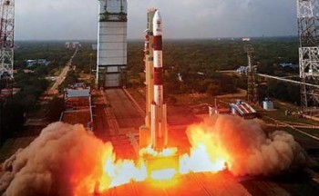
Indian Space Research Organisation (ISRO) has announced the launch of it new earth observatory called CartoSat-2C in May. The satellite shall specifically cater military demands, and shall be launched using the famous Polar Satellite Launch Vehicle (PSLV). Following this launch, India will be in equal ranks with China and USA, two of the countries who already have their spy satellite scanning activities on Earth from space. India’s first military-only satellite CartoSat-2A was launched in 2007, and since then it has been beaming highly sensitive and classified information, including neighbourhood missile launches.

The satellite was built at the Space Applications Centre (SAC) in Ahmedabad, where it undertook multiple tests to check for its functioning and durability. A couple weeks ago, CartoSat-2C was transferred to ISAC (ISRO Satellite Centre) at Bengaluru. An ISRO official has stated that though there’s very little information at their disposal about the satellite built at SAC, it’s a follow-up mission to the Cartosat series and will provide high-resolution images and videos captured from space.
As per the official report, the Cartosat-2C weights 690kgs. The high-res multi-spectral instrument and Panchromatic Camera will allow for the satellite to capture stunning sharp imagery. The military satellites launched earlier had a resolution of 0.8 meter, while the new camera mounted on the CartoSat-2C has a resolution of 0.65 meter, that is it can even capture smaller objects more accurately from space. The camera on the new military satellite can not only capture high-resolution images, but also reduce its size and transmit the file back to Earth.
CartoSat-2C, along with 21 other satellites, shall be launched using PSLV in May this year. Our ‘sharpest eyes in the sky’ shall run in a sun-synchronous polar orbit at a low-earth altitude of approximately 200-1200 kms from Earth’s surface following the launch.
Indian Space Research Organisation (ISRO) has announced the launch of it new earth observatory called CartoSat-2C in May. The satellite shall specifically cater military demands, and shall be launched using the famous Polar Satellite Launch Vehicle (PSLV). Following this launch, India will be in equal ranks with China and USA, two of the countries who already have their spy satellite scanning activities on Earth from space. India’s first military-only satellite CartoSat-2A was launched in 2007, and since then it has been beaming highly sensitive and classified information, including neighbourhood missile launches.
The satellite was built at the Space Applications Centre (SAC) in Ahmedabad, where it undertook multiple tests to check for its functioning and durability. A couple weeks ago, CartoSat-2C was transferred to ISAC (ISRO Satellite Centre) at Bengaluru. An ISRO official has stated that though there’s very little information at their disposal about the satellite built at SAC, it’s a follow-up mission to the Cartosat series and will provide high-resolution images and videos captured from space.
As per the official report, the Cartosat-2C weights 690kgs. The high-res multi-spectral instrument and Panchromatic Camera will allow for the satellite to capture stunning sharp imagery. The military satellites launched earlier had a resolution of 0.8 meter, while the new camera mounted on the CartoSat-2C has a resolution of 0.65 meter, that is it can even capture smaller objects more accurately from space. The camera on the new military satellite can not only capture high-resolution images, but also reduce its size and transmit the file back to Earth.
CartoSat-2C, along with 21 other satellites, shall be launched using PSLV in May this year. Our ‘sharpest eyes in the sky’ shall run in a sun-synchronous polar orbit at a low-earth altitude of approximately 200-1200 kms from Earth’s surface following the launch.